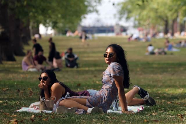
Weather forecast London today: what is the Met Office prediction for 2 August 2022, and long range forecast
and live on Freeview channel 276
Just over a week has passed since the summer solstice, which traditionally marks the start of the summer, where we have blue skies, warm weather and longer evenings.
This year, we have endured the worst weather that mother nature has had to offer, with Storm Eunice and Storm Franklin causing schools, offices and even supermarkets to close early, as well as some sporting events to be called off.
Advertisement
Hide AdAdvertisement
Hide AdThis year was also the first time for almost half a decade that somewhere in the UK was issued with a weather warning.
With most of us basking in glorious weather recently, is that set to continue?
Here’s the latest weather forecast for London.


What is today’s weather forecast in London?
Today will be cloudy changing to sunny by night time.
The highest temperature will be 26C, which you can expect by 4pm. The lowest will be 16C.
What is the Met Office outlook for the weekend?
Saturday, 30 July ‘After a dry and bright start to Saturday, the cloud will thicken for a time with an isolated shower possible. Sunny spells developing again later. Feeling pleasant in the sunshine. Maximum temperature 28 °C.’
Advertisement
Hide AdAdvertisement
Hide AdSunday: ‘Often cloudy on Sunday with the chance of some patchy rain, especially in the north.’
What is the Met Office long-range weather forecast?
The Met Office also provides a long-range weather forecast that usually covers the whole month.
Their long range weather forecast, which is general for the whole UK and isn’t specified to one specific area, says: “Changeable conditions are expected in the north at the start of the period, with cloud and outbreaks of rain that may be locally heavy at times.
“Mainly dry in the south with sunny periods, though some slight showers are possible and it could be fairly cloudy in the west at first. Temperatures near normal in the north, warm to very warm in the south.
Advertisement
Hide AdAdvertisement
Hide Ad“The changeable regime will continue through the period in the north, with stronger winds and further outbreaks of rain at times.
“It will most likely be drier for central and southern areas, but some light rain remains possible here too.
“Temperatures generally above average, but closer to average in the north and potentially feeling very warm to locally hot in the southeast.”
This long range forecast is from 2 August to 11 August.
“While many areas are likely to see drier than average conditions through August, the north could endure some periods of organised rain.
Advertisement
Hide AdAdvertisement
Hide Ad“Any precipitation in the south, and particularly the southeast, is likely to be in the form of showers or thunderstorms.
“Temperatures likely continuing to be above normal for most areas, particularly in the south where they could be significantly above normal.”
This forecast is from 12 August to 26 August.
Is the Met Office reliable?
Overall, the Met Office is an extremely reliable source of weather information, and this is proven with statistics. On their official website, they say: “92.5% of the Met Office’s next day temperature forecasts are accurate within 2 degree C and 92% of the Met Office’s next day wind speed forecasts are correct within 5 knots.”
Also, they provide much more than weather.
They provide pollen count, and also information regarding safety tips such as how to prepare your home for a storm, such as securing outdoor furniture to tips on what to do during a storm, if needed.
Comment Guidelines
National World encourages reader discussion on our stories. User feedback, insights and back-and-forth exchanges add a rich layer of context to reporting. Please review our Community Guidelines before commenting.
