Storm Eunice 2022: when will strong wind and rain hit London how long will it last - and weather forecast

and live on Freeview channel 276
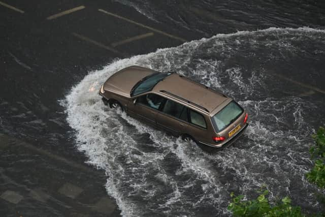
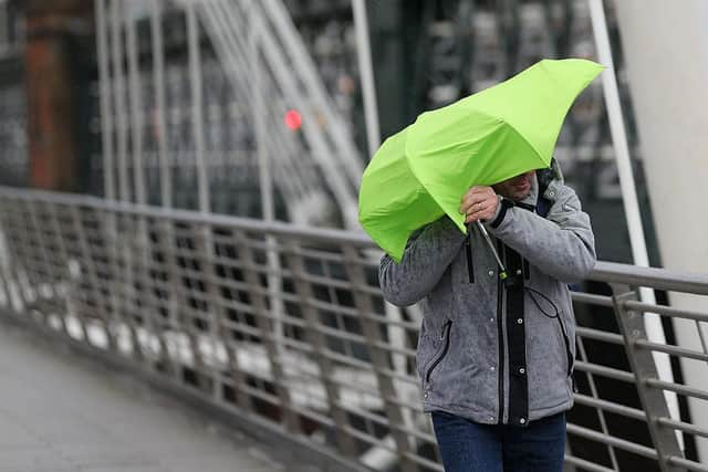
Storm Eunice is set to batter London on Friday, with the Met Office warning that buildings and homes could be damaged and there is a “danger to life”.
Advertisement
Hide AdAdvertisement
Hide Ad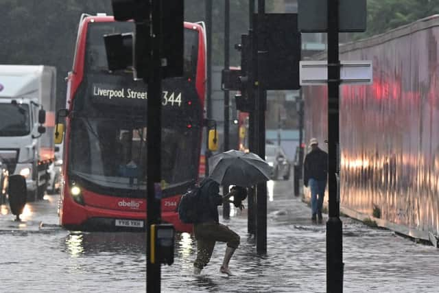

Earlier in the week, Londoners’ houses were rattled by Storm Dudley, and with Storm Eunice arriving in the earlier hours, it’s brought strong winds and rainfall.
How long will Storm Eunice last?
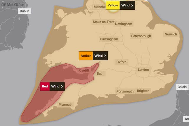
After arriving in London in the early hours of Friday morning, The Met Office upgraded London’s amber warning to red, the most severe.
The red warning came into play at 10am in London, and will last until 3pm.
Advertisement
Hide AdAdvertisement
Hide AdAfter that, the initial amber warning issued will last until 9pm, with wind speeds exceeding 40mph.
Yellow weather warnings are currently in place for the north of England for wind and snow. Snow is not predicted to hit London during Storm Eunice, however.
A rare red weather warning has been issued for parts of the south-west of England and parts of south Wales, meaning there is a danger to life due to flying debris.
What does a red weather warning mean?
Advertisement
Hide AdAdvertisement
Hide AdLondon has been issued with a red warning for wind, which according to the Met Office means: “Dangerous weather is expected and, if you haven’t already done so, you should take action now to keep yourself and others safe from the impact of the severe weather. It is very likely that there will be a risk to life, with substantial disruption to travel, energy supplies and possibly widespread damage to property and infrastructure. You should avoid travelling, where possible, and follow the advice of the emergency services and local authorities.”
A red weather warning means:
- Flying debris resulting in danger to life
- Damage to buildings and homes, with roofs blown off and power lines brought down
- Roads, bridges and railway lines closed, with delays and cancellations to bus, train, ferry services and flights
- Power cuts affecting other services, such as mobile phone coverage
- Large waves and beach material being thrown onto coastal roads, sea fronts and homes
What weather can London expect?
London was initially issued an amber weather warning, but this morning (Friday, February 18) the warning was upgraded to red, which is extremely rare.
From mid-day is when the storm will be at its strongest bringing wind speeds of 65mph to the capital.
Wind speeds for London will not drop below 50mph until 5pm, however, wind speeds will still exceed 40mph until 8pm.
Advertisement
Hide AdAdvertisement
Hide AdThe latest red weather warning will be in place for London until 3pm, with the amber warning staying active until 9pm.
The Met Office for Friday says: “Becoming very windy during the morning as Storm Eunice brings widespread gales, or severe gales in places, especially during the afternoon, likely causing some significant disruption. Early rain clearing to brighter skies with a few blustery showers. Feeling cold. Maximum temperature 9 °C.”
By tonight: “Any showers easing, becoming largely dry with clear skies developing overnight. Winds continuing to ease, after early gales, especially on the coasts. Cold with a local ground frost in places. Minimum temperature 1 °C.”
The weather is expected to remain unsettled throughout the weekend, with showers, some longer spells of rain and windy conditions.
Advertisement
Hide AdAdvertisement
Hide AdBy Monday, the rain is expected to have cleared, with largely dry weather predicted.
Red weather warning in the west
The Met Office has issued a rare red weather warning for parts of the UK as the country prepares for strong winds and travel disruption with the arrival of Storm Eunice on Friday 18 February.
Experts predict the storm could bring the strongest winds the UK has seen in several years.
It’s been a short reprieve since Storm Dudley battered parts of Wales, Yorkshire, and Scotland this week, causing travel disruption and power cuts, and Eunice is expected to be even more powerful and widespread.
In Scotland, the severe weather left many trains cancelled on Wednesday night (February 16) with more train lines remaining suspended on 17 February.