London weather: Met Office issues thunderstorm warnings as heavy rain forecast

and live on Freeview channel 276
Heavy rain and thunderstorms are expected to sweep across London on Wednesday (August 2) causing flooding and travel disruption, according to the Met office.
The forecaster has issued a yellow thunderstorm warning for the capital with 20-25mm of rain expected to fall within an hour and possibly 40mm in two to three hours in a few places in the country.
Advertisement
Hide AdAdvertisement
Hide AdThe Met Office said it is likely there might be “some damage to a few buildings” from lightning strikes and driving conditions “will be affected by spray and standing water.”
It is expected that car and bus journeys will be longer with delays to train services also possible.
The Met Office added that it is likely that there could be some “short term loss of power” on Wednesday.
The thunderstorm alert in London is in place from 9am to 7pm.
Advertisement
Hide AdAdvertisement
Hide Ad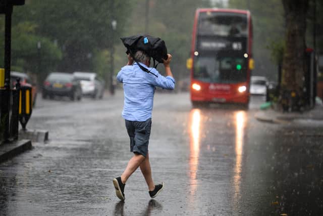

The warnings come after endless days of rain, and even storms, with weather conditions feeling rather dark and gloomy.
The Met Office has confirmed that conditions will remain unsettled through the start of August, with days of sunny spells and showers perhaps interspersed with periods of more persistent rain as low pressure systems move across the UK.
In the later half of August, there is an increased chance the unsettled conditions will continue with a mixture of rain and showers continuing to affect the whole country.
There is a possibility for short-lived drier, brighter and occasionally warmer interludes towards the end of August but the Met Office has dashed any hopes of a heatwave by saying that “a prolonged dry and hot spell is unlikely”.
Advertisement
Hide AdAdvertisement
Hide AdWhat is the Met Office saying?
Met Office Chief Meteorologist, Dan Suri, said: “An unseasonably deep area of low pressure for the time of year will move into Ireland during the early hours of Wednesday then continue across Wales and England during Wednesday daytime.
“Heavy rain associated with this low will affect large parts of the UK tonight and on Wednesday, some of the heaviest rain occurring on Wednesday over central parts of England and Wales where some locations could see 40mm of rain in just a few hours from thundery downpours.
“This deep low will also bring high winds into the UK on Wednesday, especially the south. Gusts of up to 60mph are possible in the very far southwest early on Wednesday whilst further along the south coast the highest gusts will be during Wednesday daytime.
“Despite the centre of the low pressure crossing the UK, the highest wind speeds will be further south over northern France and the Channel Islands. The low will pull away eastwards from the UK during Wednesday evening and night, leaving a calmer day on Thursday though some heavy showers could persist in the east.”
Comment Guidelines
National World encourages reader discussion on our stories. User feedback, insights and back-and-forth exchanges add a rich layer of context to reporting. Please review our Community Guidelines before commenting.