London weather: Met Office issues amber thunderstorm warning as London prepares for potential flooding

and live on Freeview channel 276
The Met Office has upgraded their weather warning for London from a yellow thunderstorm alert to an amber thunderstorm alert.
It comes as parts of the UK are still under a yellow thunderstorm warning, stemming from the extreme heat that occurred in July and earlier this month.
Advertisement
Hide AdAdvertisement
Hide AdThough much needed rainfall has been needed in the UK as droughts have been called up and down the country, flooding is expected due to the dryness of the ground being unable to soak up the moisture quickly.
Why has the Met Office issued an amber weather warning?
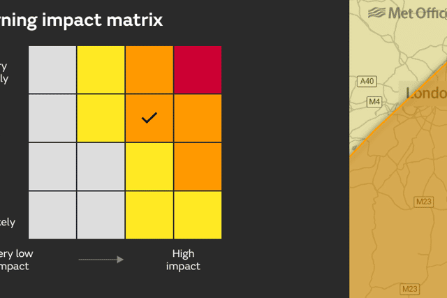

In the official statement released alongside the amber weather warnings, the Met Office has forecast that heavy showers and thunderstorms expected today could lead to some flooding and disruption.
The Met Office said: “Some places will miss these, but where they do occur, 30 to 50 mm of rain could fall in less than an hour and a few places may see in excess of 100 mm in a few hours where storms are slow moving.
“Lightning and hail will be additional hazards. Showers and storms will slowly die out this evening.”
Londoners are advised to expect:
Advertisement
Hide AdAdvertisement
Hide Ad- Flooding of homes and businesses is likely and could happen quickly, with damage to some buildings from floodwater, lightning strikes, hail or strong winds
- Fast flowing or deep floodwater is likely, causing danger to life
- Where flooding or lightning strikes occur, delays and some cancellations to train and bus services are likely
- Spray and sudden flooding probably leading to difficult driving conditions and some road closures
- Some communities likely to become cut off if roads flood
- Power cuts likely to occur and other services to some homes and businesses could be lost
When will the amber warning come into effect in London?
The Met Office has confirmed that the amber weather warning for London and the South East of England will be in effect from 11:00am today (August 17) until 10:00pm this evening.
The forecast for the next five days in London is currently:
- Thursday: Cloudy changing to sunny intervals by lunchtime (26c/19c)
- Friday: Light showers turning to sunny intervals by late morning (24c/14c)
- Saturday: Sunny changing to cloudy in the afternoon (23c/15c)
- Sunday: Cloudy (23c/17c)
- Monday: Cloud changing to light rain by mid morning (23c/17c)
- Tuesday: Cloudy changing to sunny intervals by lunchtime (24c/16c)
What is the long-range forecast for London?
The torrential weather looks to continue in London and the south of England throughout August, according to the Met Office’s long-range forecast.
They have warned of a frontal system bringing widespread rainfall, which could then effect the rest of the UK.
21 - 30 August
Showers remain in the north on Sunday, but more general rain is starting to move in from the west. Heavy bursts are likely at times. Eastern areas may remain dry until late Sunday evening, western upslopes seeing the most of any persistent heavy rain.
Advertisement
Hide AdAdvertisement
Hide AdWinds are generally light but becoming stronger with the arrival of rain, with a chance of coastal gales. Through this period, frontal systems are likely to bring widespread rainfall. Rain across central and southern regions initially could become more widespread and affect all parts for a time before becoming more settled.
Fine and dry conditions prevail for many areas. With light winds and plenty of sunshine, warm temperatures can be expected for this period, generally rising, feeling humid at times.
29 August - 12 September
After settled conditions carried through the end of August, September is likely to bring some more unsettled weather for many. Early to mid-September will see widely unsettled patterns prevailing across the UK. Temperatures warm and possibly remain warm throughout this period.
Why are there thunderstorms in the UK suddenly?
As warm air rises it cools and condenses, forming small droplets of water. If there is enough instability in the air, the updraft of warm air is rapid and the water vapour will quickly form a cumulonimbus cloud. Typically, these cumulonimbus clouds can form in under an hour.
Advertisement
Hide AdAdvertisement
Hide AdA negative charge at the base of the cloud is attracted to the Earth’s surface and other clouds and objects. When the attraction becomes too strong, the positive and negative charges come together, or discharge, to balance the difference in a flash of lightning (sometimes known as a lightning strike or lightning bolt).
The rapid expansion and heating of air caused by lightning produces the accompanying loud clap of thunder.
Comment Guidelines
National World encourages reader discussion on our stories. User feedback, insights and back-and-forth exchanges add a rich layer of context to reporting. Please review our Community Guidelines before commenting.