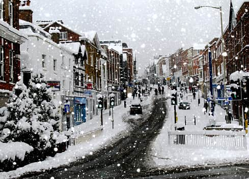
Met Office weather warnings across UK: Country to be hit with ice, snow & high winds - how long it will last
and live on Freeview channel 276
The UK is set to experience a cold snap for another week following last week’s heavy snowfall, with temperatures expected to drop and widespread heavy rain and snowfall forecast.
Scotland, Northern Ireland, and north and central England have all received a yellow snow and ice warning that comes into effect from today, March 13, at 5pm until Tuesday, March 14, at 11am. From 10am to 6pm today, a yellow wind warning has been issued for the southern region, which includes London and Brighton.
Advertisement
Hide AdAdvertisement
Hide AdAccording to the Met Office, while temperatures in the south are expected to be above 10C on Monday morning, the northern areas may see a low of 3C, which could gradually drop to 0C as a result of low pressure moving eastward across the UK.
On Sunday, the UK Health Security Agency (UKHSA) issued a new weather alert warning that the freezing conditions “could increase the health risks to vulnerable patients and disrupt the delivery of services”.
Daniel Rudman, a Met Office Deputy Chief Forecaster said: “There is an increasingly strong signal for colder air to once again feed into the north of the UK during Monday. This flow is likely to extend southwards with much of the UK likely to be under the influence of colder conditions overnight into Tuesday.
“Tuesday is set to remain a cold day, but it is not expected to be as cold as conditions have been (last week), and there will be brighter periods for most. There are likely to be some showers too, although any snowfall is expected to be over higher elevations.”
Advertisement
Hide AdAdvertisement
Hide AdMeanwhile, a weather system to the west is expected to bring milder conditions in, which will bring more rain, particularly to higher ground in the west of the UK, but there is still a chance of snow in the north.
5-day weather forecast
Today (March 13)
Heavy rain, at times falling as snow, will continue across northern Scotland before drifting erratically south later. Elsewhere, blustery winds and showery rain for many, though the east is often drier. Away from the colder north, mild/very mild.


Overnight, rain, turning to snow over low-lying terrain, continues south across most areas, clearing completely by morning in the far south. Windward coasts will see snow showers. It’s getting colder.
Tuesday (March 14)
Snow showers for the north and east windward coasts, while a more organised band of rain, sleet, and snow pushes southeast across other areas. Feeling cold all around.
A cold start to the day on Wednesday, with snow showers in the north. Rain or showers, heavy in the west, spreading northeast across many parts, with hill snow in the north.
Comment Guidelines
National World encourages reader discussion on our stories. User feedback, insights and back-and-forth exchanges add a rich layer of context to reporting. Please review our Community Guidelines before commenting.
