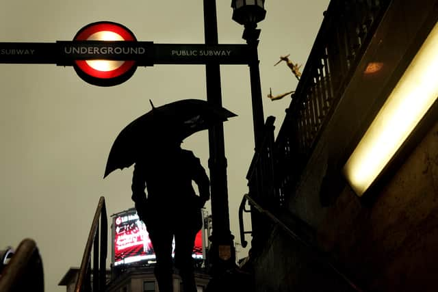
London blood rain 2022: what is it, Met Office London thunderstorm alert, will there be lightning strikes?

and live on Freeview channel 276
The Met Office has issued a yellow status weather warning for London.
Advertisement
Hide AdAdvertisement
Hide AdThe weather alert is valid between 7pm on Wednesday and 3am on Thursday.
There’s also a chance London and parts of the south East could see ‘blood rain’ before the end of the week.
Blood rain is the meteorological phenomenon that happens when stormy conditions mix with sand from Sahara Desert.

What is blood rain?
Blood Rain is what happens when a dust cloud from the Sahara Desert in northern Africa clashes with stormy conditions and heavy downpours.
Advertisement
Hide AdAdvertisement
Hide AdThe red coloured dust can turn the skyline a red and orange colour hence the name blood rain.
Richard Miles, from the Met Office, said: “There are some dust concentrations in the atmosphere above the UK at present which might well be washed out in the rain tonight, but it’s likely to be relatively small amounts on the whole.
“There’s a warning out for thunderstorms for the south-eastern third of England tonight, and a squally cold front will bring wind and sometimes heavy rain to Northern Ireland and north-west Scotland this evening.
“Away from these features it will be mostly fine and dry on Wednesday and tomorrow, temperatures up to 23-24C in London and the south-east, high teens or low 20s elsewhere.”
Why did the Met Office issue the warning?
Advertisement
Hide AdAdvertisement
Hide AdThe details of the warning can be accessed on the Met Office website:
“Developing showers and thunderstorms are likely to intensify across parts of the warning area through the evening, before easing away eastwards after midnight.,” said the Met Office.
“Quite a lot of places will probably avoid the heaviest rain and thunder, but others could experience torrential downpours and frequent lightning, while large hail and strong wind gusts may also affect a few places.”
The Met Office added: “Central parts of southern England are perhaps most likely to see impacts.
Advertisement
Hide AdAdvertisement
Hide Ad“Rainfall amounts will be highly variable, as is usual in such situations, but the wettest spots perhaps seeing around 25 mm of rain inside an hour, and a possibility that somewhere could catch over 40 mm in 2 or 3 hours.”
What should we expect?
- Spray and sudden flooding could lead to difficult driving conditions and some road closures.
- Where flooding or lightning strikes occur, there is a chance of delays and some cancellations to train and bus services, as well as possible power cuts.
- There is a small chance that homes and businesses could be flooded, with damage due to floodwater or lightning strikes.
London & South East England weather forecast
Wednesday 18 May - Sunday 22 May
This Evening and Tonight:
Showers and thunderstorms will develop through the evening, with torrential downpours, lightning and hail locally, mainly in eastern parts.
Showers clearing east later in the night, followed by clear spells for some but some residual rain in the east.
Minimum temperature 11 °C.
Thursday:
Some residual cloud and perhaps the odd outbreak of drizzle at first in Kent but fine and dry elsewhere, with light winds and plenty of sunshine. Warm. Maximum temperature 24 °C.
Rain and showers after a sunny start on Friday, perhaps heavy later. Dry and bright on Saturday, some sunshine. Plenty of sunshine on Sunday. Temperatures near average.
Comment Guidelines
National World encourages reader discussion on our stories. User feedback, insights and back-and-forth exchanges add a rich layer of context to reporting. Please review our Community Guidelines before commenting.